Juwangsan National Park Autumn Walk: Daejeonsa, Rock Gorges and Waterfalls
Follow Juwang Valley in Cheongsong, with a clear distinction between a shorter walk and the full waterfall route
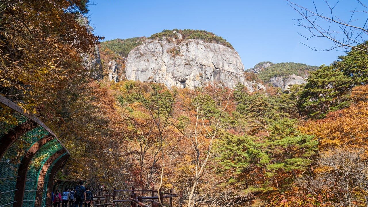
At Juwangsan, the rock faces make the forest look smaller. Branches frame broad stone surfaces, and the path leads into gaps that are easy to miss in a distant mountain view.
Juwangsan National Park in Cheongsong, southeastern South Korea, offers a valley-focused alternative to treating every mountain visit as a summit hike. Daejeonsa Temple, a narrow gorge and waterfall pools give the walk its shape.
For a first visit, the key choice is how far to continue. The route toward Yongchu Waterfall and the longer trail beyond it have different surfaces and time requirements. Autumn scenery is another reason to look closely, rather than a promise that the forest is at peak color today.
The wider forest view keeps the stone wall behind the trees. Leaves add texture, while the rock supplies the scale that makes this landscape distinctive.
Korea Tourism Organization describes Juwangsan as a national park of rocky peaks, valleys, temples and waterfalls. The valley route offers a way to see those contrasts without making the summit the goal.
A good walk here can be built around changing viewpoints: the outline of a cliff, then a temple courtyard, then water caught between rocks.
Juwangsan National Park begins at a human scale
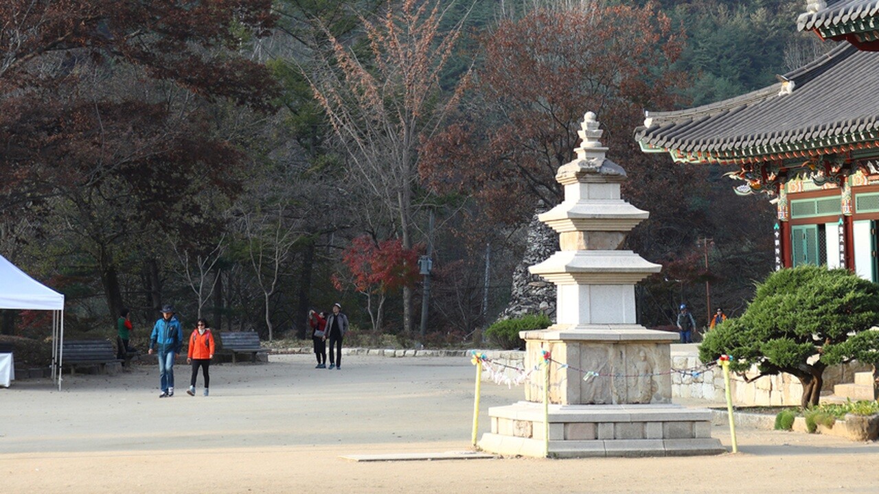
At Daejeonsa, the pagoda and roof bring the view down from the mountain to the courtyard. Their ordered lines contrast with the rough surfaces deeper in the valley.
The Korea National Park Service valley-route guide lists the full route as 5.3 kilometers one way, about 2 hours 10 minutes. Its round-trip estimate is 10.6 kilometers and 4 hours 20 minutes; these are not the figures for a brief temple stroll.
Choosing a turnaround point before continuing helps keep a scenic walk within a realistic day. Time spent looking at the temple or taking photographs comes in addition to the walking estimate.
Walk through the gap in the cliffs
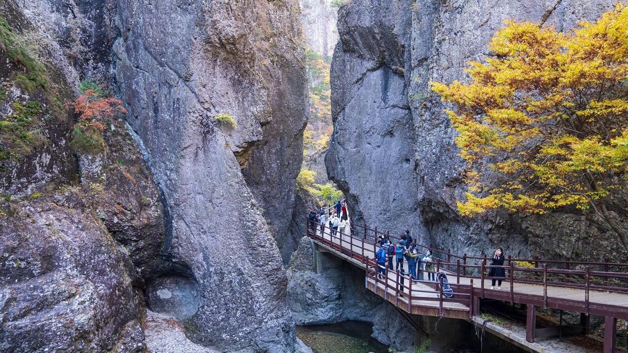
The walkway runs beside a gap between large rock faces. People in the view show the scale more clearly than a close photograph of stone alone.
The official guide gives the Sangui Parking Lot–Yongchu Waterfall section as 2.7 kilometers and about 75 minutes one way. It describes this approach as comparatively level and suitable for strollers and wheelchairs.
That description applies to the named section. It should not be extended to every path or waterfall in the park, and current access controls still matter.
See the pool as well as Yongchu Waterfall
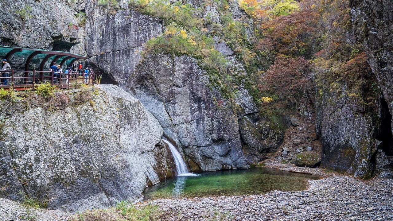
The narrow cascade, pool and surrounding walls form one scene. Keeping the wider setting in view explains why the waterfall belongs to this rocky valley.
Water volume and light can vary. The photograph illustrates the landform, rather than documenting the flow a visitor will find on a particular day.
Beyond Yongchu, KNPS describes a stonier route with wooden bridges and difficulties for wheelchairs and strollers. A low-difficulty classification does not mean that every section has the same surface.
Longer waterfall views require a different plan
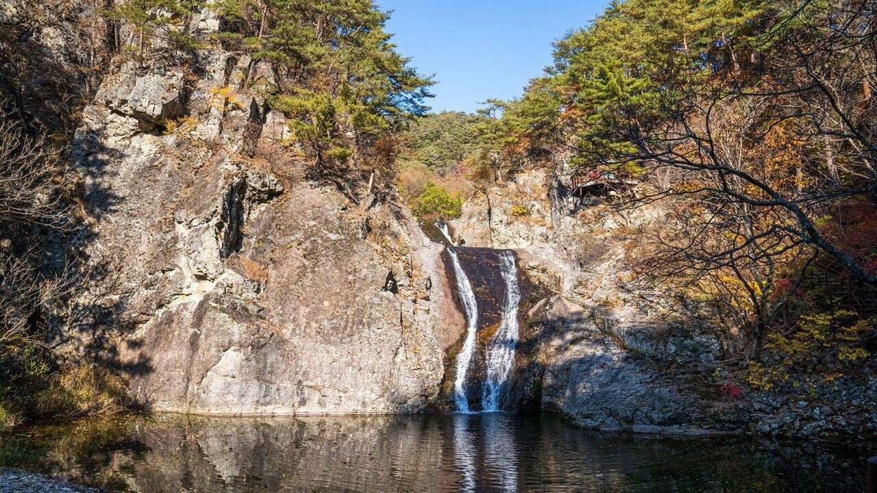
Yongyeon offers another contrast between a broad stone surface and a thin line of falling water. Continuing toward it is a longer outing than returning from Yongchu.
KNPS recommends the valley for fall scenery from mid-October into early November as general seasonal guidance. The Korea Meteorological Administration observation page currently has no first-foliage or peak date recorded for Juwangsan.
A seasonal recommendation and an observed peak are different kinds of information. Neither the archive photographs nor a nationwide forecast establishes the color of this entire trail today.
Return through the woodland at your own pace
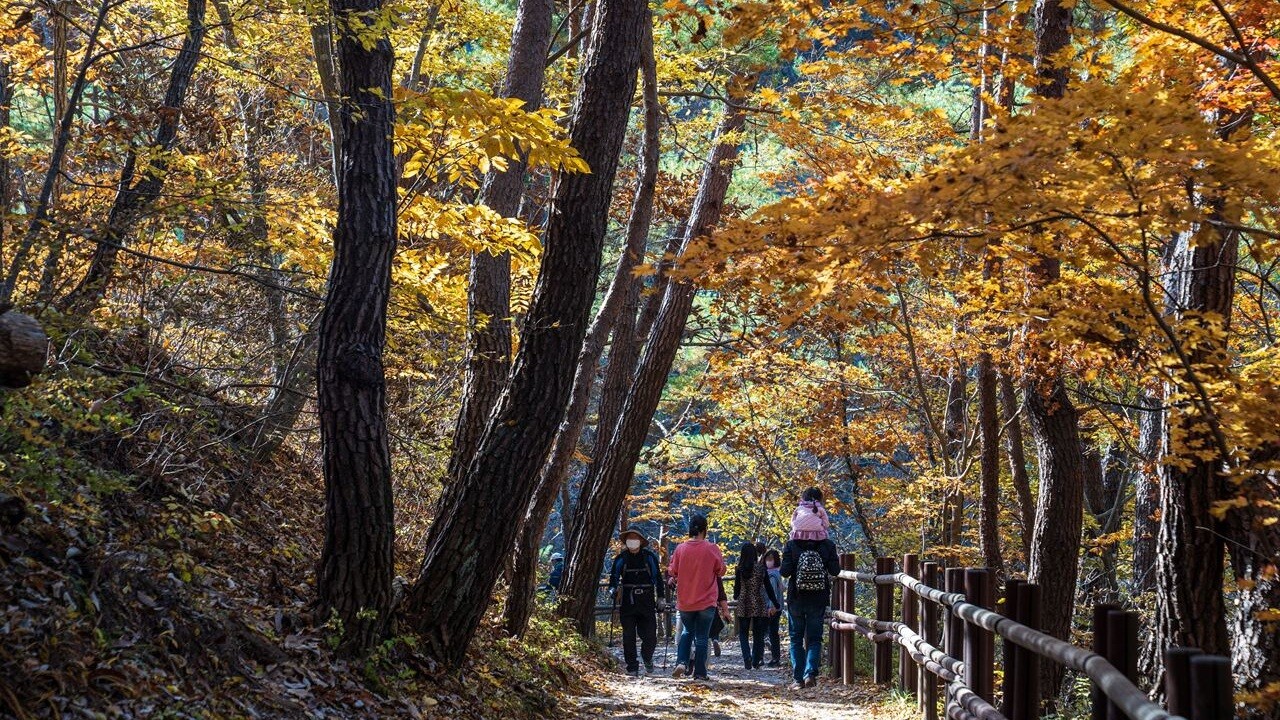
Among the trees, the scale becomes smaller again. Trunks and the curve of the trail replace the large cliff faces that framed the earlier views.
For another valley-centered destination, compare the Jujeongol Valley autumn walk. It is in Seoraksan, a different region; the two are alternatives for separate trips, not neighboring stops.
Juwangsan suits a day organized around the relationship between temples, rock and water. Pick the length that fits the group, and leave time to notice how the scenery changes along the way.
You May Also Like
by Google Adsense