Gangcheonsan County Park Walk: Forest Paths, Falls and a Suspension Bridge
Gangcheonsan County Park, Sunchang — valley scenery below the mountain ridges
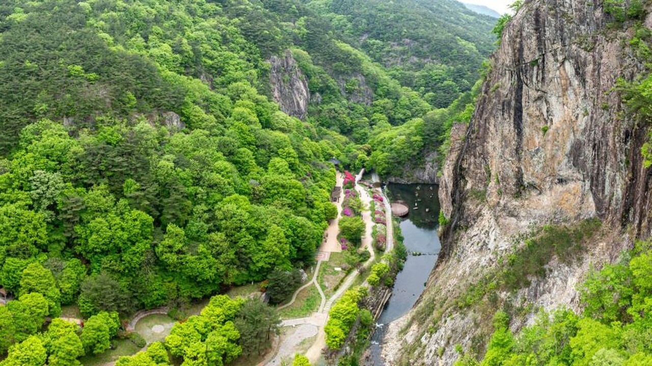
Rock walls rise beside a densely wooded valley at Gangcheonsan County Park. Paths and water occupy the lower space, while a red suspension bridge draws a line above the trees. The setting is easier to understand as several levels of scenery than as one summit to reach.
This county park is in Paldeok-myeon, Sunchang County, in Jeonbuk State. Sunchang’s English tourism description emphasizes the valley, rock formations and seasonal woodland. For visitors choosing between a scenery walk and a ridge hike, those are different ways to use the same broad park.
Current foliage and a verified 2026 local peak date are not established here. The photographs illustrate forest paths, water and rock faces. The green trees in these scenes should not be interpreted as a report of conditions on your travel date.
A broad path in one photograph does not establish the terrain of every route. Waterfall viewpoints, the suspension bridge and mountain trails have different settings. Choose the scope of a visit from the actual route information rather than treating all of them as one effortless loop.
Forest paths reveal the space between the trees
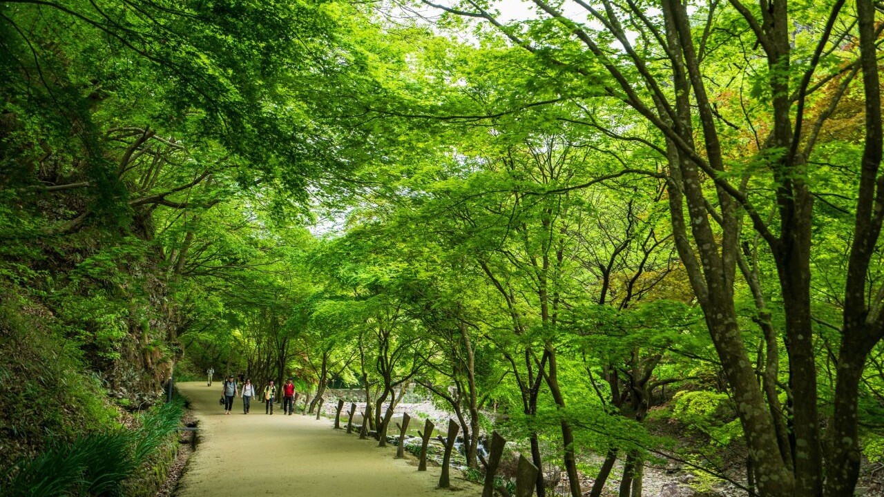
Branches overlap above a broad path, and the tree rows continue into the distance. Nearby trunks partly hide those behind them. That repeated spacing gives the woodland depth before any discussion of leaf color.
In a dense canopy, shade occupies more of the scene than open sky. A walking figure provides a reference for tree height and path width. It changes the view from an abstract green surface into a space that people move through.
For a fall travel plan, the useful feature is the layout of the woodland as well as its changing leaves. A specific canopy color cannot be promised from these images. The path and its framing trees offer several scales to notice.
Gangcheonsan County Park has a closer stream landscape
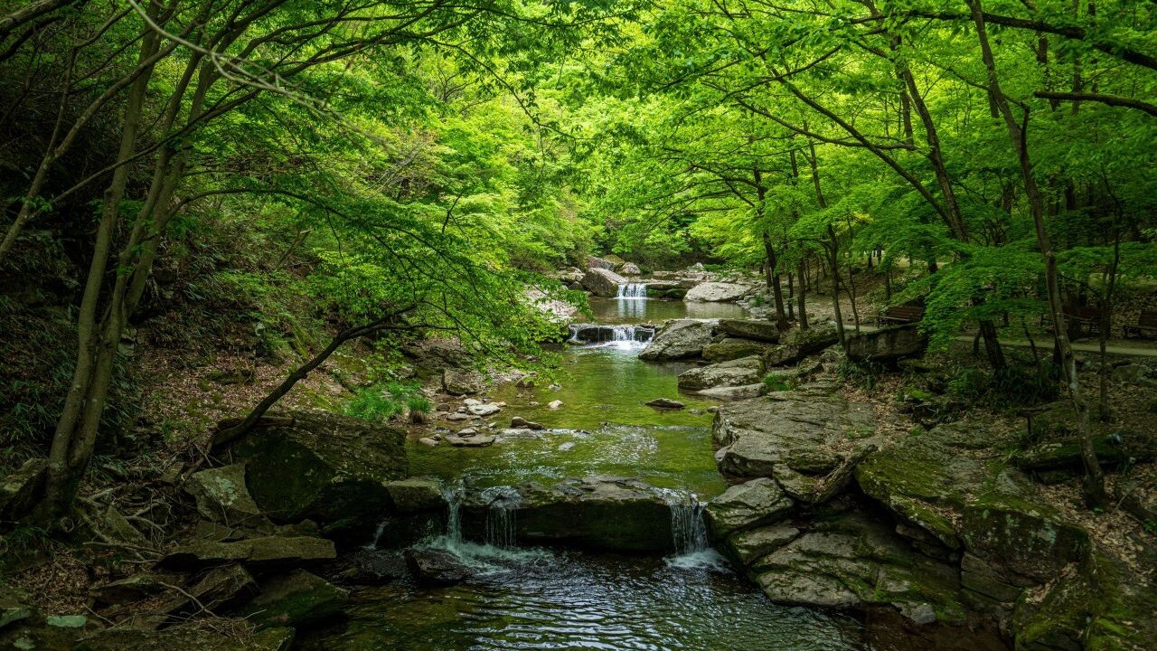
Small drops between stones create a series of narrow water lines. A wider pool gives way to a tighter gap, while low branches cover parts of the stream. This enclosed scene has a different character from a tall waterfall viewed across an open space.
A valley also contains changes in the ground around it. A broad viewing area and a rocky section are not equivalent terrain. Photographs of a path should not be used to classify every possible route as level or accessible.
Water volume and nearby foliage can change with the weather and season. This image explains the relationship between rocks, branches and water. It is not a promise that the same flow will be present every day.
A temple gate adds another kind of structure
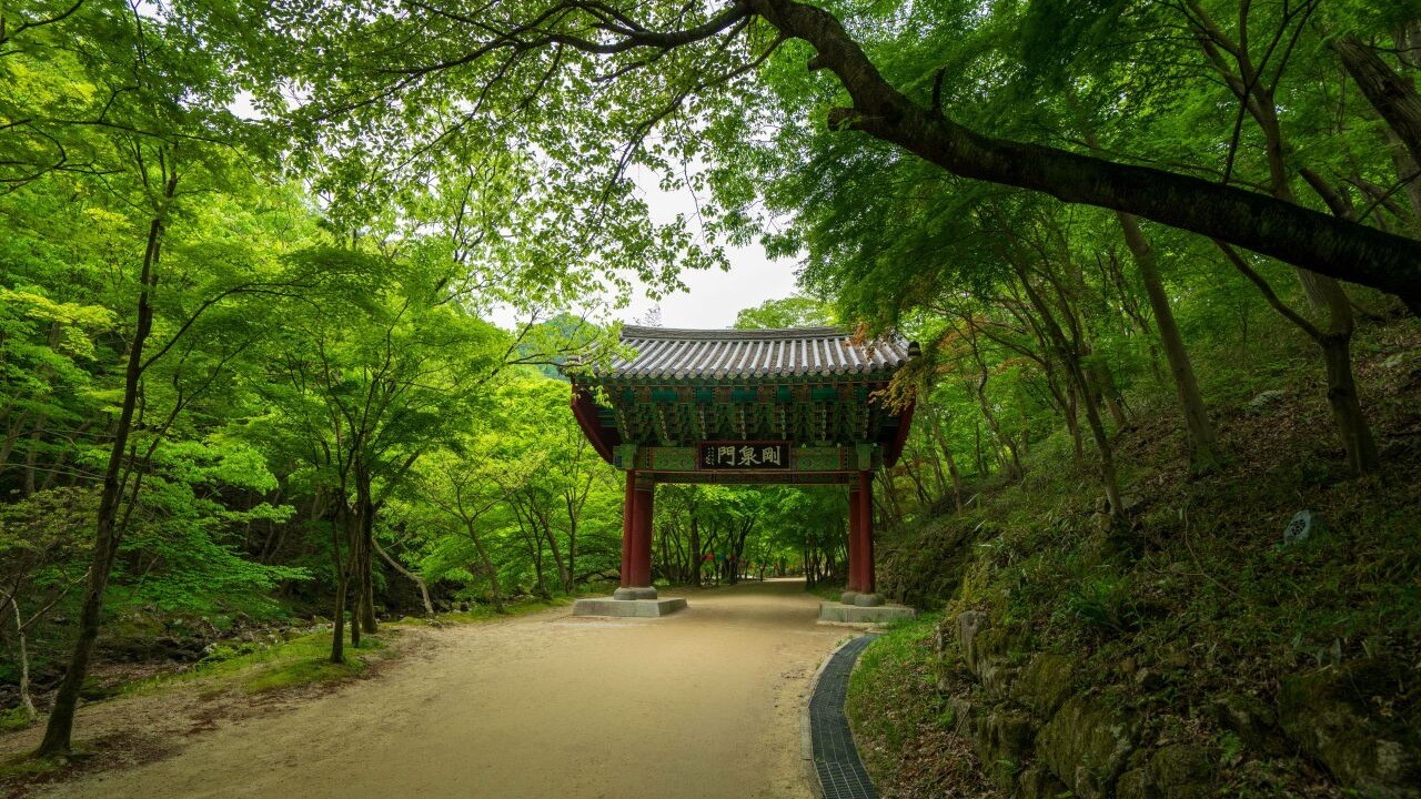
The photographed gate introduces straight architectural lines beneath the branches. Columns mark the vertical edges while the roof creates a horizontal frame. The path continues through that frame into the wooded setting.
The county’s valley-route description also includes Gangcheonsa Temple. A religious site has visitor boundaries rather than unrestricted access to all its buildings. A visible path does not imply permission to enter every hall or residential area. The temple setting asks for a different kind of attention from an ordinary forest viewpoint.
Following the visual sequence from water to a gate shows how the park combines landscape with buildings. The gate is not simply another object to check off. It changes how the surrounding path and trees are framed.
The suspension bridge draws a line above the valley
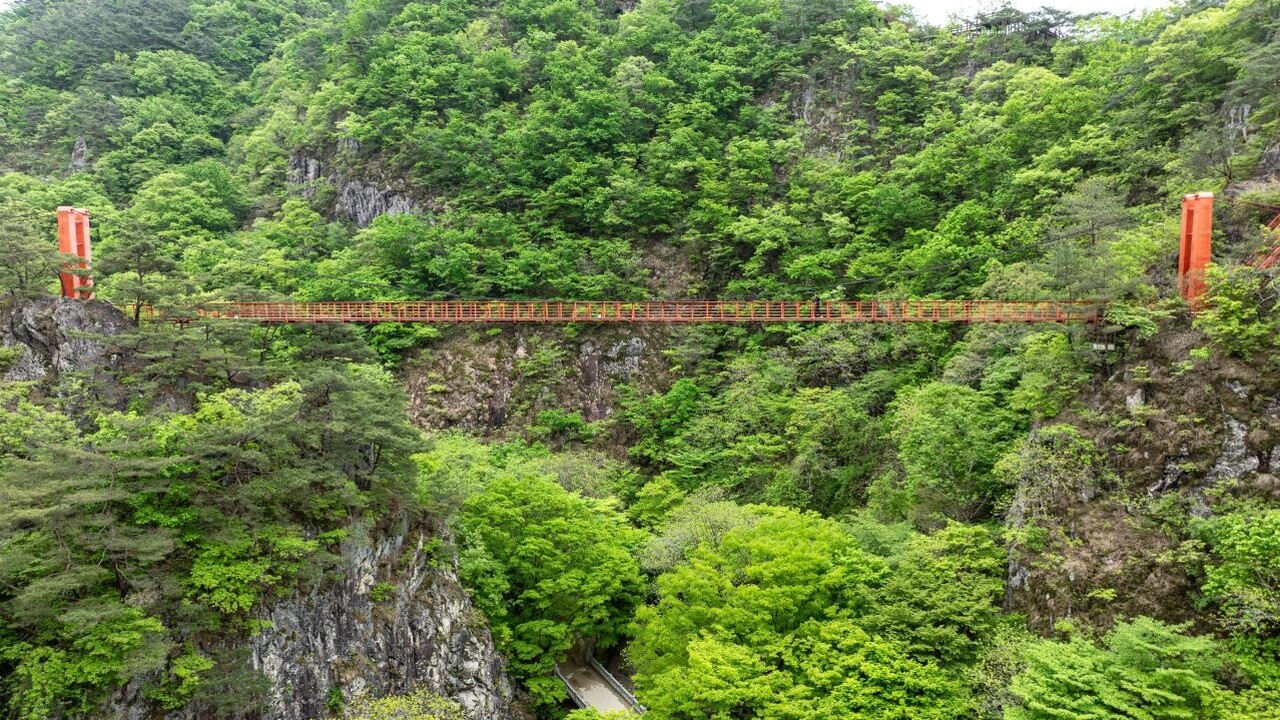
The red bridge extends across the trees, with rocks and woodland visible beneath it. Its color separates the structure from the canopy, while the space below makes its position easier to judge.
Viewing the bridge from a distance and crossing it are different experiences. A valley scenery visit does not automatically need to become a high-bridge outing or a ridge hike. The photographed scene helps explain that choice without making it for every traveler.
For a separate forest-and-temple setting, compare Songnisan’s Sejo Trail. Songnisan and Sunchang are different regional destinations. They are alternatives to assess, rather than a short local extension of the same walk.
Waterfalls make the rock walls feel taller
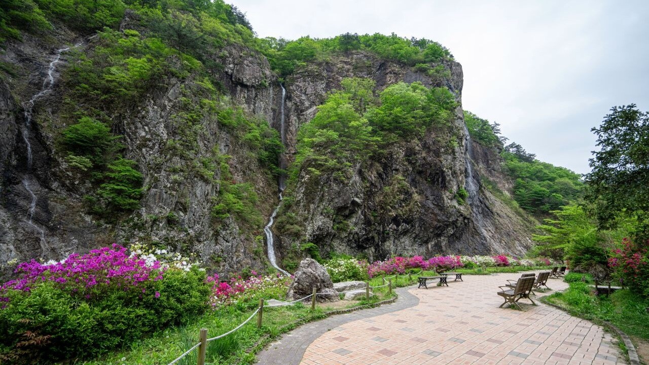
The path below Byeongpung Falls sits beside a broad rock face. Following the falling water upward gives the scene a vertical dimension that the shaded paths do not emphasize. Trees, rock and a viewing space occupy different parts of the frame.
Sunchang’s current Korean visitor page groups Byeongpung Falls, Gangcheonsa, the suspension bridge and Gujanggun Falls in its valley-route description, while listing summit hikes separately. Operating arrangements may change with weather. The route grouping explains the scenery, not guaranteed access on every date.
Gangcheonsan is useful to consider as a valley landscape with several changes of height and scale. Follow the routes actually permitted on site, and let the paths, water and rock faces define the visit rather than relying on one predicted leaf-color moment.
You May Also Like
by Google Adsense